

Wake County, North Carolina is growing, and fast. In 2013, to better manage this exponential growth that adds 63 people per day, the city of Raleigh (at the heart of Wake County), adopted a new “Unified Development Ordinance” (UDO). The UDO has been successful in many respects by encouraging compact, pedestrian-oriented development to preserve natural resources and enhance overall quality of life1.
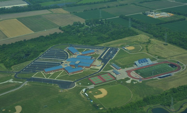
In spite of this success, the UDO has a major flaw with respect to the siting and size of schools2. This flaw comes in a new provision3 that states that “Schools must be located on a lot with a total area of 500 square feet per pupil enrolled.”4 A school’s lot, which includes its building as well as its playfields and parking lots, would therefore need a studio apartment-sized chunk of land for each enrolled student. A school of 500 students, for example, would need to sit on a 5.7-acre lot at minimum. In effect, this onerous new rule requires schools to be located in the suburbs, where acres of land are more readily available for development.
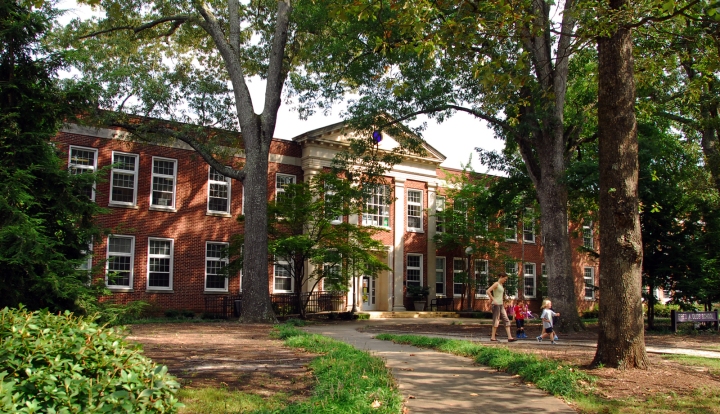
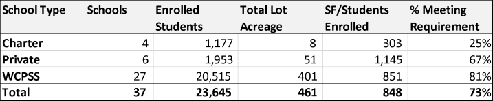
Inside the I-440 Beltline which encircles downtown Raleigh and its first-ring neighborhoods, nearly 30% of K-12 schools would be illegal under the new ordinance. This includes older neighborhood schools such as Olds and Partnership Elementary Schools (303 and 276 SF per pupil, respectively) as well as high-performing and non-traditional schools in downtown such as Raleigh Charter High (287 SF), Moore Square Magnet (401 SF) and the Longleaf School of the Arts (155 SF).
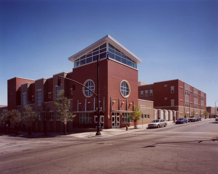
This new rule will be particularly challenging for charter schools, private schools, and early childhood learning centers seeking new spaces. Charter schools tend to make use of non-traditional spaces such as vacant office or strip retail buildings that are on small lots before finding a permanent home. Given the lot size requirement, the diminishing amount of developable land inside the beltline, and rising land values that are already some of the highest in the southeastern U.S., charter schools are effectively forced to look outside of the Beltline for cheap land and large lots. This may not be a problem for many charters, but for those which seek to locate close to low-income families in Southeast Raleigh to improve racial disparities in education, there are very few (if any) sizable lots in the neighborhood to spare, much less for a price that a charter school could afford.
Why was this anti-urban provision included in the UDO? Regardless of the reason, it seems likely to drive development even farther into the suburban fringes of Wake County rather than to allow for the flexibility to site schools in ways that are compatible with compact neighborhoods and school choice. For the sake of developing neighborhoods that can accommodate families and allow for a range of school options including public, charter, and private, the Raleigh City Council should change the provision to dramatically decrease, if not outright eliminate, the school lot size requirement.
[1] Raleigh UDO §1.1.1.1.4.
[2] In Raleigh UDO §6.3.1.D.1, schools are given the following definition: “A public or private (including charter or religious) school at the primary, elementary, middle, junior high or high school level that provide basic academic instruction.”
[3] Raleigh UDO §6.3.1.D.2.b.
[4] Additional requirements for schools include: schools must not be located in the airport or watershed overlays, nearby roads must not fall below “D” level of service given increased traffic, and the school site must A1 or A2 protective yard for res uses or C2 for public right of way.
About the author: Tim J. Quinn is a second year master’s student in City and Regional Planning specializing in real estate and economic development. Prior to coming back to graduate school, Tim worked as an elementary teacher for three years in Colorado Springs, Colorado. His experience in the classroom continues to inform his research interests, which include innovative apprenticeship programs, school siting policy, and innovation districts.
